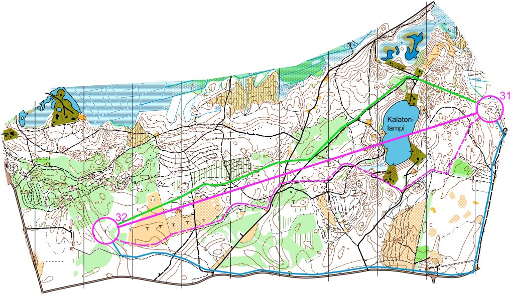
Juha Rehula’s route choice (purple):
The aim is to use as much paths and as clear route as possible. Take the bearing from the compass to the corner of the path and follow until the vegetation boundary. You can spot the dense area on the left. Thereafter there is approximately one kilometre on path on a terrain with a good runnability. The depressions along the route can be avoided except for one. There would surely be a route from the left side without any depressions, but it would be many hundred meters longer. Approaching the control is possible from the path crossing, running alongside the vegetation boundary of the clearing until the edge of the open area. The control is located in a shooting platform, which can likely be spotted from a quite far distance. Depending on the runnability of the clearing I would most likely take a direct route fot the last half a kilometre with the shooting platforms “making the route” to the control flag.
Seppo Väli-Klemelä’s route choice (green):
My choice is to go straight to the path along the northside of pond Kalatonlampi until the north side of the open area, from where I would take a shortcut to smaller rides and taking thereafter a straight line to the control flag. There are no big elevation gains or thickets, so longer bypassing is not necessary, even if the summer night would be darker. The other option (blue) is to go backwards from the control to the path and to pass the whole route from the left by using path and the road. This route is 640 meters longer but justifiable, is you, for example have had injuries hindering an efficient advancing in the terrain.


